The Stephen Headland is the northernmost region of Peace Island
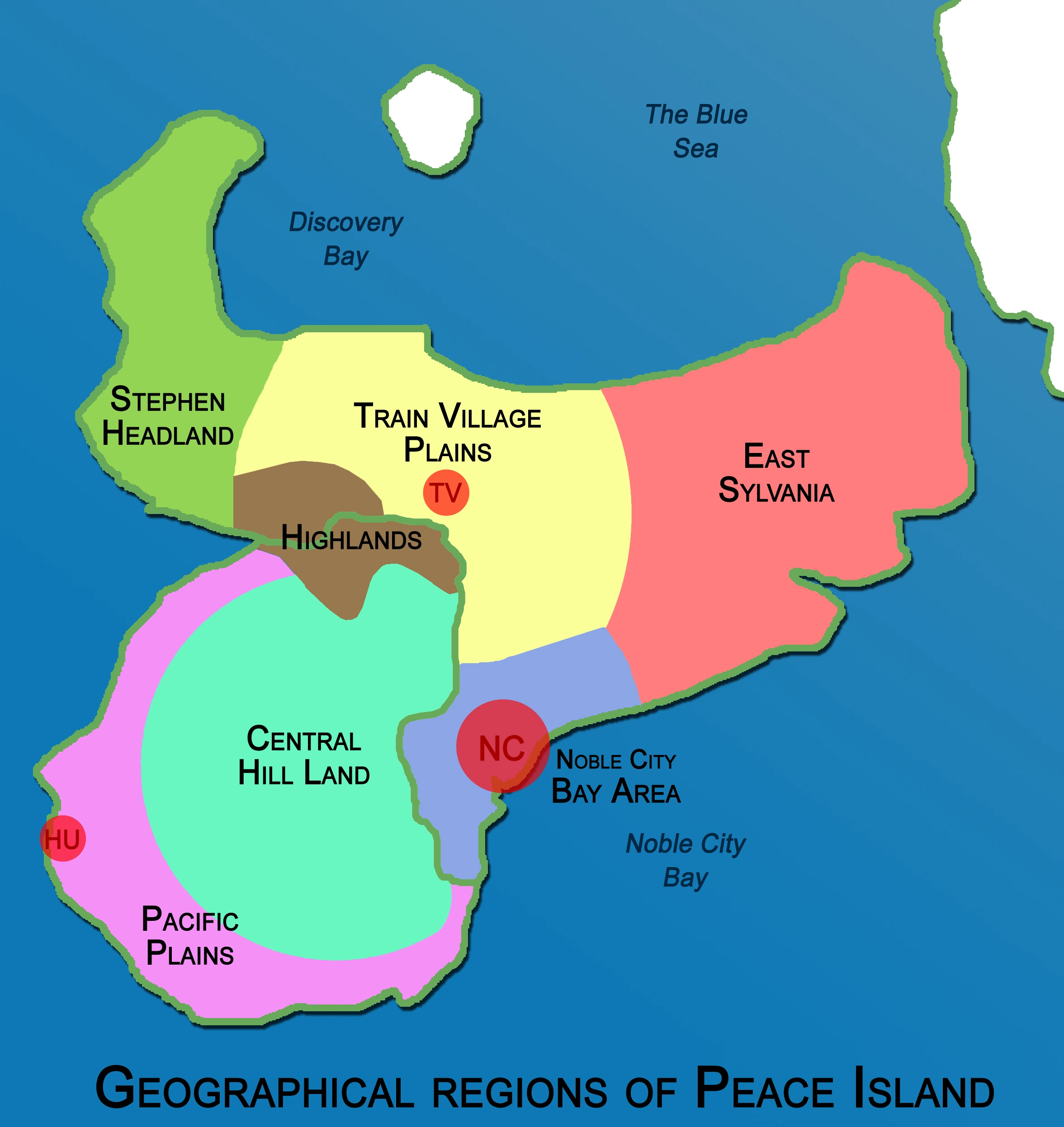
Stephen Headland is a Lovian peninsula in Peace Island. It is located beside the Pacific Ocean, specifically Discovery Bay. It belongs to the State of Sylvania and the geographical region of Eastern Peace Island. There are 851 people residing within Stephen Headland.
History[]
Stephen Headland was discovered by Miguel Castillo y Espada around 1775. Though not entirely proven, it is quite possible this was true. It was only until the 1890s that the peninsula was charted onto the history books, when it was named after Founding Father Stephen Robinson shortly after his death. In 1896, Hawaiian-American businessman Charles H. Morgan began the Morgan Plantation along its north shore; this would eventually lead to the establishment of the village of Charleston.
In 1910, the SS Maria sunk of the north coast with valuable cargo and treasure; since then many have come here to try and find treasure.
The region is often nicknamed the Horn, after its form. In that representation, the entire island is often regarded as a bull's or deer's head.
Geography[]
The Stephen Headland is surrounded by the Pacific Ocean to the west, the Blue Sea to the north, and the Discovery Bay to the east. It is a part of the State of Sylvania. It is the warmest area of Sylvania with the most mediterranean climate and vegetation. The headland isn't densely populated at all and is rather hard to reach. The region is considered a part of Western Peace Island and is situated near the Train Village Plains and the Highlands.
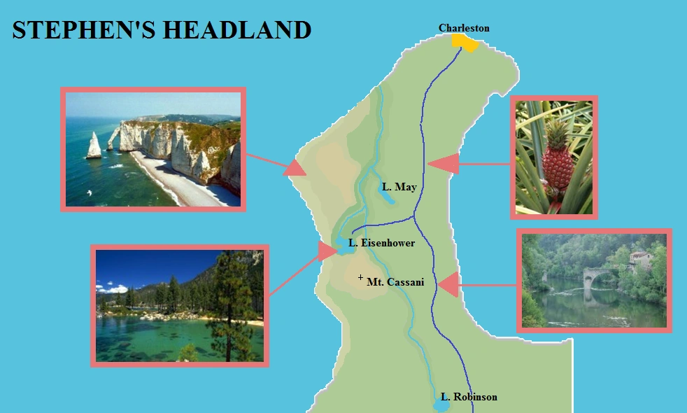
In the west of the island (mainly at the Western Cliffs and Coastal Heights) is the Stephen Headland National Park.
Western Cliffs[]


Along the western coast of the headland, the Western cliffs are located. These massive walls of white stone go almost straight down. A small portion of the cliffs has access to a 5 mile-long beach.
Coastal Heights[]
The Coastal Heights is the region next to the cliffs. This area consists of two highland regions. The highest point in the cape, Mt. Cassani (1003 ft.) is found in the southern heights.
Bonney River Valley[]
The Bonney River Valley is one of the main geographic regions of the headland. This long and winding valley is also known as the three lakes valley. The Bonney River (named after naturalist Chester E. Bonney), for the most part, is in the Bonney Gorge, and begins at the south of the headland at Lake Robinson. Further downstream, there are confluences with Pineapple Creek, whose source is at Lake May and with the western arm (the Little River), which begins at Lake Eisenhower .
Central Plains[]
The Central Plains is the largest geographic formation in the region. This one stretches from Charleston in the north to the bottom of the cape, and from the center to the east. Here is where all the pineapples are grown, and where most farms are found.